We left the
quiet of the California Coast, Monterey, and the redwoods for the Palm Springs
area of southern California. We parked
in Indio, a small oasis park in the desert.
A few rural communities and large cities with their irrigated lawns and
gardens interrupted the desert drive between Monterey and Indio.
 The expanse of desert reminded us again, as
it did on our cross country trip a few years ago, how rural and undeveloped we
are in many regions in our country.
California’s drought was well demonstrated by the persistent haze that
hung over southern California.
The expanse of desert reminded us again, as
it did on our cross country trip a few years ago, how rural and undeveloped we
are in many regions in our country.
California’s drought was well demonstrated by the persistent haze that
hung over southern California. 
Looking
across the horizon, in all directions, the clear crisp outlines of the
surrounding geography that we had enjoyed along the coast were replaced with
persistent haze. The slightest breeze
stirred the sand and dust blowing it in drifts and waves across the landscape.
These two
day drives require a spot to camp overnight.
The expanse of desert between Monterey and Indio didn’t leave many
options. Researching campsites and
routes led us to Mojave! Dry, barren, remote. We pulled in, plugged in, hooked up, and went
for a walk along the desert sidewalks of an undeveloped neighborhood. Weeds growing in the cracks in the road and
along the edges of the sidewalk testified to the harsh economic realities of
building neighborhoods in this part of California.
 We arrived
in Indio, a low rent neighbor to the more populated and affluent Palm Springs just a few miles away. We stayed at a luxurious, grassy park with
two pools, morning buffet of waffles and OJ by the pool, water aerobics in the
morning sun and many social opportunities.
It was a real community with people who’ve been returning for years and
act as hosts to various daily social outings.
We tried the chair yoga once, skipped the happy hour, and went to the
Thursday night movie complete with cookies, drinks and free popcorn. It was fun and easy to reach out and meet
other travelers.
We arrived
in Indio, a low rent neighbor to the more populated and affluent Palm Springs just a few miles away. We stayed at a luxurious, grassy park with
two pools, morning buffet of waffles and OJ by the pool, water aerobics in the
morning sun and many social opportunities.
It was a real community with people who’ve been returning for years and
act as hosts to various daily social outings.
We tried the chair yoga once, skipped the happy hour, and went to the
Thursday night movie complete with cookies, drinks and free popcorn. It was fun and easy to reach out and meet
other travelers.
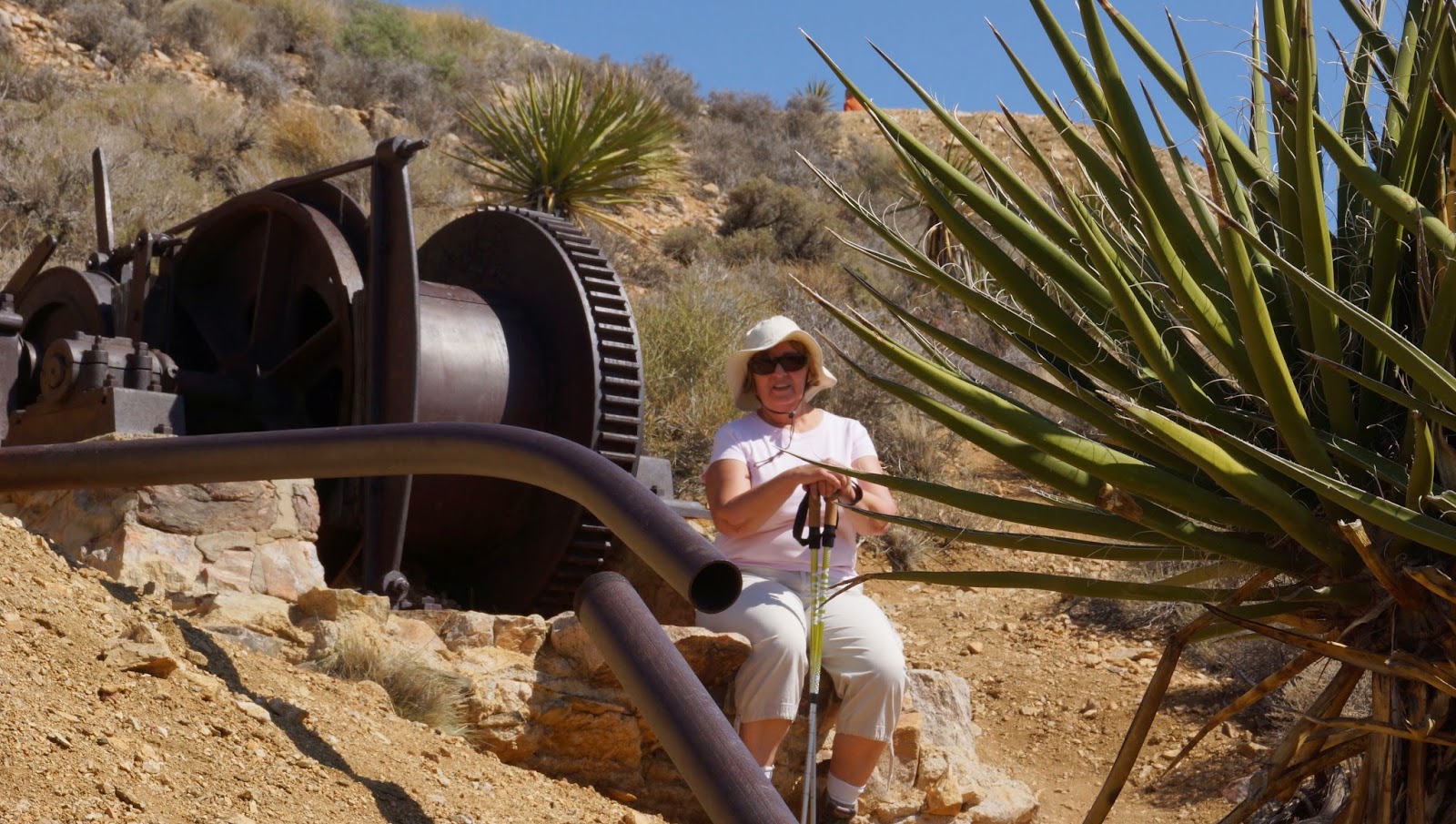
Indio was a
launching point to sites in the Joshua Tree National Park for outdoor
explorations and some city sightseeing in nearby Palm Springs.

Indio Performing Arts Center provided a
pleasant nightlife opportunity to see ‘Country Queens in Concert’. Bethany Owens did a one woman show
impersonating legends of country and pop music.
With simple, on stage costume/wig changes she took us through songs of
Cher, Dolly Parton, Loretta Lynn, Tammy Wynett and more.


